Extreme heat warning for SA: Monday temperatures could exceed 40 degrees celcius
Extreme temperatures and localised storms threaten SA
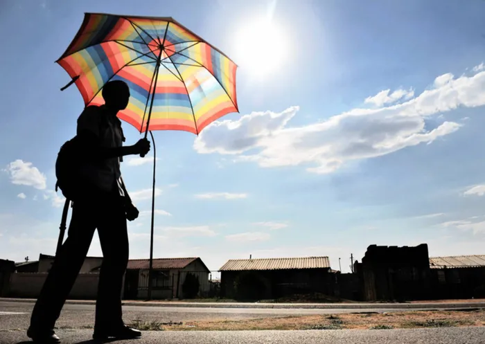
Image: Matthews Baloyi
South Africa is heading into an intense midsummer day on Monday with extreme heat taking centre stage across large parts of the country, while scattered thunderstorms bring some relief and risk to the interior.
The South African Weather Service (SAWS) warns that conditions will be uncomfortable to dangerous in several regions, especially where temperatures soar into the high 30s and low 40s.
The Western Cape will experience a tale of two climates. While coastal areas such as the Cape Peninsula and parts of the Overberg remain cooler and occasionally cloudy, the Central and Little Karoo are set to endure very hot to extremely hot conditions.
Daytime temperatures in these interior valleys are expected to reach the high 30s and may exceed 40 degrees in places.
By the afternoon, cloud build-up over the north-eastern parts of the province may trigger isolated showers and thundershowers, with rain chances around 30%, though most areas will remain dry. Fire danger will be extremely high.
Across the Northern Cape, the heat will be relentless. Fine to partly cloudy skies will allow temperatures to climb rapidly, becoming very hot during the day.
Isolated afternoon showers and thundershowers are possible, mainly over the eastern parts, with rain chances near 30%. Despite these storms, widespread rainfall is not expected, and the dominant feature remains the oppressive heat.
The Free State and North West Province will also bake under hot to very hot conditions. Morning sunshine will give way to increasing cloud in the afternoon, when isolated showers and thundershowers are likely.
Rain chances sit around 30%, but where storms do develop, they may become severe, bringing strong winds, heavy downpours, hail and dangerous lightning, particularly over central and eastern Free State and southern parts of North West.
Gauteng will see a partly cloudy and warm to hot day, with afternoon showers and thundershowers expected. Rain chances are around 30%, increasing towards the southern parts of the province.
Some of these storms may be intense, with localised flooding and damaging winds possible. The UV index will be high, making sun protection essential even before storms arrive.
In Mpumalanga and Limpopo, morning fog and drizzle along the escarpment will give way to warm to hot conditions.
Isolated afternoon showers and thundershowers are expected mainly over the Highveld, with rain chances near 30%, while the Lowveld stays mostly dry and hot.
The Eastern Cape will experience widespread heat, with some areas becoming extremely hot, especially inland.
The western half will see isolated showers and thundershowers, increasing to scattered storms in the north with rain chances reaching 60%.
The eastern half of the province can expect scattered showers and storms more broadly, also with rain chances around 60%, while coastal winds strengthen later in the day.
KwaZulu-Natal will be partly cloudy and warm to hot, turning very hot in the east. Isolated showers and thundershowers are expected mainly in the west and south, with rain chances close to 30%.
Along the coast, moderate to fresh north-easterly winds will persist, and the UV index will remain high.
Authorities advise staying hydrated, avoiding direct sun during peak hours, wearing light and loose clothing, and remaining indoors in cool spaces where possible.
Children, the elderly, pets, and those with medical conditions are particularly vulnerable, and residents are reminded never to leave anyone in parked vehicles.
Medical attention should be sought immediately in case of dizziness, nausea, confusion, or fainting.
IOL News