Saturday's weather: Level 5 severe storm warning for Mpumalanga and Limpopo
The SA Weather Service has issued weather warning for the Mpumalanga and Limpopo lowveld.
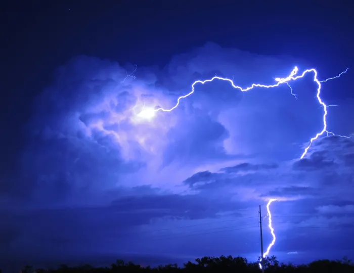
Image: Unsplash
The South African Weather Service has issued severe weather and fire danger warnings for several provinces, with thunderstorms, heavy downpours, high winds, and extreme temperatures expected in various regions over the coming days.
An Orange Level 5 Warning for severe thunderstorms has been issued for the Lowveld regions of Mpumalanga and Limpopo.
SAWS has warned of heavy downpours that could lead to flooding of susceptible roads, low-lying areas, and bridges. Strong, damaging winds and hail are possible, as well as excessive lightning.
A Yellow Level 2 Warning has been issued for the Escarpment of Mpumalanga and Limpopo, western North West, extreme eastern Northern Cape, western and central Free State, and northern Eastern Cape.

Rainfall patterns for Saturday, January 10.
Image: SAWS
Severe thunderstorms with heavy downpours in these areas may cause localised flooding. Strong winds, hail, and excessive lightning could also occur.
An extremely high fire danger is anticipated over parts of the Eastern Cape’s Sarah Baartman and Nelson Mandela municipalities, as well as large areas of the Northern Cape, and parts of the Western Cape and Free State.
Very hot to extremely hot conditions are expected over most regions, except the south coast of the Western Cape.
Gauteng
Partly cloudy and warm, with isolated showers and thundershowers. The UVB sunburn index is high.
Western Cape
Cloudy in the central and eastern areas in the morning, and along the south coast in the afternoon. Otherwise, fine and hot to very hot, extremely hot in the northern West Coast District. Coastal winds will be fresh to strong south-easterly to easterly, moderate along the west coast. The UVB sunburn index is very high.
KwaZulu-Natal
Morning fog patches over the interior, otherwise partly cloudy and cool to warm with scattered showers and thundershowers. Coastal winds will be moderate southerly to south-easterly, becoming north-easterly in the south by evening. The UVB sunburn index is moderate.
Residents are urged to stay updated on weather conditions, avoid flood-prone areas during heavy downpours, take precautions against extreme heat, and adhere to fire safety measures in high-risk regions.
Mpumalanga
Cloudy and cool to warm, with scattered showers and thundershowers, widespread in the Lowveld and northern escarpment.
Limpopo
Cloudy and warm to hot, with isolated to scattered showers and thundershowers in the west, becoming widespread in the east.
North West Province
Fine in the west and central areas in the morning, then partly cloudy, windy, and warm to hot. Showers and thundershowers will be isolated but scattered in the west.
Free State
Fine in the west and central areas in the morning, otherwise partly cloudy, windy, and warm to hot, with scattered showers and thundershowers. Isolated showers in the extreme east where morning fog is expected.
Northern Cape
Cloudy with morning fog in north-western areas. Otherwise, fine, windy, and hot to very hot, partly cloudy with isolated showers and thundershowers in the east and central areas, scattered in the extreme east. Coastal winds will be light to moderate southerly to south-easterly.
Western Half of the Eastern Cape
Cloudy with morning fog in places, becoming partly cloudy and warm, hot in the extreme north with isolated thundershowers. Coastal winds will be fresh to strong easterly.
Eastern Half of the Eastern Cape
Cloudy with light morning rain south of the escarpment, becoming partly cloudy and warm with scattered showers and thundershowers, isolated in the west. Coastal winds will be moderate easterly, becoming fresh to strong north-easterly in the afternoon.
Temperatures
- Johannesburg: 17/30
- Pretoria: 19/33
- Durban: 21/26
- Cape Town: 18/27
- Bloemfontein: 16/36
- Polokwane: 18/31
- Qgeberha: 18/2
- East London: 18/27
IOL News